Weather Alert in South Carolina
Coastal Flood Advisory issued August 21 at 10:43AM EDT until August 21 at 9:00PM EDT by NWS Wilmington NC
AREAS AFFECTED: Coastal Horry; Coastal Georgetown
DESCRIPTION: * WHAT...For the High Surf Advisory, large breaking waves of 4 to 7 feet in the surf zone. For the High Rip Current Risk, dangerous rip currents. For the Coastal Flood Advisory, up to one half foot of inundation above ground level expected in low- lying areas near shorelines and tidal waterways. * WHERE...Coastal Horry and Coastal Georgetown Counties. * WHEN...For the High Surf Advisory, until 11 PM EDT this evening. For the High Rip Current Risk, until 8 PM EDT this evening. For the Coastal Flood Advisory, from 5 PM this afternoon to 9 PM EDT this evening. * IMPACTS...Vulnerable causeways to and from local beaches may experience minor coastal flooding. Low-lying roads and locations along the Intracoastal Waterway and adjacent tidal creeks may observe minor coastal flooding. Check with local officials for the latest information regarding coastal flood impacts and closures. Dangerous swimming and surfing conditions and localized beach erosion. Rip currents can sweep even the best swimmers away from shore into deeper water. * ADDITIONAL DETAILS...Affected areas listed are based on average tide conditions. Additional locations may experience flooding during periods of heavy rainfall, high winds, or other factors.
INSTRUCTION: If travel is required, allow extra time as some roads may be closed. Do not drive around barricades or through water of unknown depth. Take the necessary actions to protect flood-prone property. Inexperienced swimmers should remain out of the water due to dangerous surf conditions. Swim near a lifeguard. If caught in a rip current, relax and float. Don't swim against the current. If able, swim in a direction following the shoreline. If unable to escape, face the shore and call or wave for help.
Want more detail? Get the Complete 7 Day and Night Detailed Forecast!
Current U.S. National Radar--Current
The Current National Weather Radar is shown below with a UTC Time (subtract 5 hours from UTC to get Eastern Time).

National Weather Forecast--Current
The Current National Weather Forecast and National Weather Map are shown below.

National Weather Forecast for Tomorrow
Tomorrow National Weather Forecast and Tomorrow National Weather Map are show below.

North America Water Vapor (Moisture)
This map shows recent moisture content over North America. Bright and colored areas show high moisture (ie, clouds); brown indicates very little moisture present; black indicates no moisture.

Weather Topic: What are Nimbostratus Clouds?
Home - Education - Cloud Types - Nimbostratus Clouds
 Next Topic: Precipitation
A nimbostratus cloud is similar to a stratus cloud in its formless,
smooth appearance. However, a nimbostratus cloud is darker than a stratus cloud,
because it is thicker.
Unlike a stratus cloud, a nimbostratus cloud typically brings with it the threat
of moderate to heavy precipitation. In some cases, the precipitation may evaporate
before reaching the ground, a phenomenon known as virga.
Next Topic: Precipitation
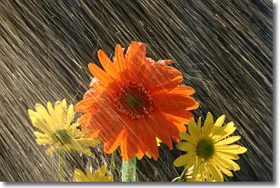
Weather Topic: What is Rain?
Home - Education - Precipitation - Rain
 Next Topic: Shelf Clouds
Precipitation in the form of water droplets is called rain.
Rain generally has a tendency to fall with less intensity over a greater period
of time, and when rainfall is more severe it is usually less sustained.
Rain is the most common form of precipitation and happens with greater frequency
depending on the season and regional influences. Cities have been shown to have
an observable effect on rainfall, due to an effect called the urban heat island.
Compared to upwind, monthly rainfall between twenty and forty miles downwind of
cities is 30% greater.
Next Topic: Shelf Clouds
Current conditions powered by WeatherAPI.com


