Weather Alert in Oregon
Fire Weather Watch issued September 2 at 3:55AM PDT until September 3 at 9:00PM PDT by NWS Portland OR
AREAS AFFECTED: Mt. Hood National Forest Region; Southern Gifford Pinchot National Forest; Mt. Adams Ranger District of the Gifford-Pinchot National Forest
DESCRIPTION: The National Weather Service in Portland has issued a Fire Weather Watch for thunderstorms, which is in effect from Wednesday afternoon through Wednesday evening. * AFFECTED AREA...In Oregon, Fire Weather Zone 688 Mt. Hood National Forest Region. In Washington, Fire Weather Zone 634 Southern Gifford Pinchot National Forest and Fire Weather Zone 635 Mt. Adams Ranger District of the Gifford Pinchot National Forest. * THUNDERSTORMS...A 10-25% chance of thunderstorms. Storms may produce very little rainfall, increasing the risk of new fire starts from dry lightning. * OUTFLOW WINDS...Instantaneous gusts as high as 40 mph. Gusts at these speeds can be observed tens of miles away from the core of the thunderstorm. * DRY AND UNSTABLE...Unstable conditions with elevated mixing heights may promote pyroconvective activity over ongoing fires. * IMPACTS...Conditions may be favorable for rapid fire spread which may threaten life and property. Thunderstorm outflow winds may result in unanticipated erratic fire spread. High instability may result in fire growth. Frequent lightning and critically dry fuels may result in new fire starts.
INSTRUCTION: A Fire Weather Watch means that critical fire weather conditions are forecast to occur. Listen for later forecasts and possible Red Flag Warnings.
Want more detail? Get the Complete 7 Day and Night Detailed Forecast!
Current U.S. National Radar--Current
The Current National Weather Radar is shown below with a UTC Time (subtract 5 hours from UTC to get Eastern Time).

National Weather Forecast--Current
The Current National Weather Forecast and National Weather Map are shown below.

National Weather Forecast for Tomorrow
Tomorrow National Weather Forecast and Tomorrow National Weather Map are show below.

North America Water Vapor (Moisture)
This map shows recent moisture content over North America. Bright and colored areas show high moisture (ie, clouds); brown indicates very little moisture present; black indicates no moisture.

Weather Topic: What are Cumulonimbus Clouds?
Home - Education - Cloud Types - Cumulonimbus Clouds
 Next Topic: Cumulus Clouds
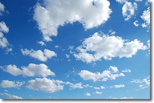
The final form taken by a growing cumulus cloud is the
cumulonimbus cloud, which is very tall and dense.
The tower of a cumulonimbus cloud can soar 23 km into the atmosphere, although
most commonly they stop growing at an altitude of 6 km.
Even small cumulonimbus clouds appear very large in comparison to other cloud types.
They can signal the approach of stormy weather, such as thunderstorms or blizzards.
Next Topic: Cumulus Clouds
Weather Topic: What is Drizzle?
Home - Education - Precipitation - Drizzle
 Next Topic: Evaporation
Drizzle is precipitation in the form of water droplets which are
smaller than raindrops.
Drizzle is characterized by fine, gently falling droplets and typically does not
impact human habitation in a negative way. The exception to this is freezing drizzle,
a condition where drizzle freezes immediately upon reaching earth's surface.
Freezing drizzle is still less dangerous than freezing rain, but can
potentially result in hazardous road conditions.
Next Topic: Evaporation
Current conditions powered by WeatherAPI.com


