Weather Alert in Indiana
Flood Warning issued February 21 at 9:05AM EST until February 22 at 7:00AM EST by NWS Indianapolis IN
AREAS AFFECTED: Jackson, IN; Lawrence, IN; Washington, IN
DESCRIPTION: ...The Flood Warning is extended for the following rivers in Indiana... East Fork White River at Seymour. .Rainfall amounts of 1 to 1.5 inches have led to rises along many rivers and streams across central and southern Indiana. Brief flooding is expected along the East Fork White River at Seymour with the river cresting Saturday afternoon just above flood stage. The river is then expected to quickly fall below flood stage and continue to fall into next week. * WHAT...Minor flooding is occurring and minor flooding is forecast. * WHERE...East Fork White River at Seymour. * WHEN...From this morning to tomorrow morning. * IMPACTS...At 12.0 feet, Significant agricultural lands begins to flood. High water affects some local roads. * ADDITIONAL DETAILS... - At 7:45 AM EST Saturday the stage was 12.0 feet. - Recent Activity...The maximum river stage in the 24 hours ending at 7:45 AM EST Saturday was 12.0 feet. - Forecast...The river is expected to rise to a crest of 12.2 feet this afternoon. It will then fall below flood stage this evening. - Flood stage is 12.0 feet. - http://www.weather.gov/safety/flood
INSTRUCTION: Turn around, don't drown when encountering flooded roads. Most flood deaths occur in vehicles. Additional information is available at www.weather.gov/ind. The next statement should be issued this evening by around 1100 PM EST.
Want more detail? Get the Complete 7 Day and Night Detailed Forecast!
Current U.S. National Radar--Current
The Current National Weather Radar is shown below with a UTC Time (subtract 5 hours from UTC to get Eastern Time).

National Weather Forecast--Current
The Current National Weather Forecast and National Weather Map are shown below.

National Weather Forecast for Tomorrow
Tomorrow National Weather Forecast and Tomorrow National Weather Map are show below.

North America Water Vapor (Moisture)
This map shows recent moisture content over North America. Bright and colored areas show high moisture (ie, clouds); brown indicates very little moisture present; black indicates no moisture.

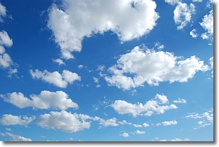
Weather Topic: What are Cumulonimbus Clouds?
Home - Education - Cloud Types - Cumulonimbus Clouds
 Next Topic: Cumulus Clouds
The final form taken by a growing cumulus cloud is the
cumulonimbus cloud, which is very tall and dense.
The tower of a cumulonimbus cloud can soar 23 km into the atmosphere, although
most commonly they stop growing at an altitude of 6 km.
Even small cumulonimbus clouds appear very large in comparison to other cloud types.
They can signal the approach of stormy weather, such as thunderstorms or blizzards.
Next Topic: Cumulus Clouds
Weather Topic: What is Drizzle?
Home - Education - Precipitation - Drizzle
 Next Topic: Evaporation
Drizzle is precipitation in the form of water droplets which are
smaller than raindrops.
Drizzle is characterized by fine, gently falling droplets and typically does not
impact human habitation in a negative way. The exception to this is freezing drizzle,
a condition where drizzle freezes immediately upon reaching earth's surface.
Freezing drizzle is still less dangerous than freezing rain, but can
potentially result in hazardous road conditions.
Next Topic: Evaporation
Current conditions powered by WeatherAPI.com


