Weather Alert in North Carolina
Severe Thunderstorm Warning issued September 4 at 5:12PM EDT until September 4 at 6:00PM EDT by NWS Greenville-Spartanburg SC
AREAS AFFECTED: Buncombe, NC; McDowell, NC; Rutherford, NC
DESCRIPTION: SVRGSP The National Weather Service in Greenville-Spartanburg has issued a * Severe Thunderstorm Warning for... Southwestern McDowell County in western North Carolina... Northwestern Rutherford County in western North Carolina... East central Buncombe County in western North Carolina... * Until 600 PM EDT. * At 512 PM EDT, a severe thunderstorm was located 13 miles east of Downtown Asheville, or near Black Mountain, moving east at 10 mph. HAZARD...60 mph wind gusts and quarter size hail. SOURCE...Public. IMPACT...Minor hail damage to vehicles is expected. Expect wind damage to trees and power lines. * Locations impacted include... Black Mountain, Old Fort, Montreat, and Lake Lure.
INSTRUCTION: Brief damaging winds will blow down trees and power lines over small areas. A brief period of large hail is also possible. Seek shelter inside an interior room. Please report damaging winds, hail, or flooding to the National Weather Service by calling toll free, 1, 800, 2 6 7, 8 1 0 1, or by posting on our Facebook page, or post it to X using hashtag nwsgsp. Your message should describe the event and the specific location where it occurred.
Want more detail? Get the Complete 7 Day and Night Detailed Forecast!
Current U.S. National Radar--Current
The Current National Weather Radar is shown below with a UTC Time (subtract 5 hours from UTC to get Eastern Time).

National Weather Forecast--Current
The Current National Weather Forecast and National Weather Map are shown below.

National Weather Forecast for Tomorrow
Tomorrow National Weather Forecast and Tomorrow National Weather Map are show below.

North America Water Vapor (Moisture)
This map shows recent moisture content over North America. Bright and colored areas show high moisture (ie, clouds); brown indicates very little moisture present; black indicates no moisture.

Weather Topic: What is Condensation?
Home - Education - Precipitation - Condensation
 Next Topic: Contrails
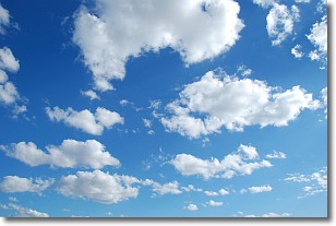
Condensation is the process which creates clouds, and therefore
it is a crucial process in the water cycle.
Condensation is the change of matter from a state of gas into a state of liquid,
and it happens because water molecules release heat into the atmosphere and
become organized into a more closely packed structure, what we might see as
water droplets.
Water is always present in the air around us as a vapor, but it's too small for
us to see. When water undergoes the process of condensation it becomes organized
into visible water droplets. You've probably seen condensation happen before on the
surface of a cold drink!
Next Topic: Contrails
Weather Topic: What are Cumulonimbus Clouds?
Home - Education - Cloud Types - Cumulonimbus Clouds
 Next Topic: Cumulus Clouds
The final form taken by a growing cumulus cloud is the
cumulonimbus cloud, which is very tall and dense.
The tower of a cumulonimbus cloud can soar 23 km into the atmosphere, although
most commonly they stop growing at an altitude of 6 km.
Even small cumulonimbus clouds appear very large in comparison to other cloud types.
They can signal the approach of stormy weather, such as thunderstorms or blizzards.
Next Topic: Cumulus Clouds
Current conditions powered by WeatherAPI.com


