Weather Alert in Illinois
Air Quality Alert issued June 16 at 3:23PM CDT by NWS St Louis MO
AREAS AFFECTED: Madison; St. Clair; Monroe; St. Charles; Franklin; St. Louis; St. Louis City; Jefferson
DESCRIPTION: The St. Louis Clean Air Partnership has issued an air quality alert for the St. Louis metropolitan area from 10 AM to 8 PM CDT Tuesday. An Orange air quality forecast means that maximum ozone concentrations are expected to reach levels that pose a health risk. Adverse health effects increase as air quality deteriorates. Ground- level ozone is an air contaminant which can cause breathing difficulties for children, older adults, as well as persons with respiratory problems. Reducing outdoor physical activity is recommended. If it is a regularly scheduled work day you are urged to consider telecommuting, carpooling, or utilizing public transit. Avoid excessive idling and do not top off when refueling motor vehicles. The use of gasoline-powered lawn equipment should be reduced or postponed until late in the day. For more information visit the St. Louis Clean Air Partnership at http://cleanair-stlouis.com/ For current Air Quality Index (AQI) values visit https://www.airnow.gov/
INSTRUCTION: N/A
Want more detail? Get the Complete 7 Day and Night Detailed Forecast!
Current U.S. National Radar--Current
The Current National Weather Radar is shown below with a UTC Time (subtract 5 hours from UTC to get Eastern Time).

National Weather Forecast--Current
The Current National Weather Forecast and National Weather Map are shown below.

National Weather Forecast for Tomorrow
Tomorrow National Weather Forecast and Tomorrow National Weather Map are show below.

North America Water Vapor (Moisture)
This map shows recent moisture content over North America. Bright and colored areas show high moisture (ie, clouds); brown indicates very little moisture present; black indicates no moisture.

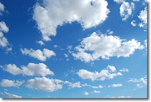
Weather Topic: What are Cumulonimbus Clouds?
Home - Education - Cloud Types - Cumulonimbus Clouds
 Next Topic: Cumulus Clouds
The final form taken by a growing cumulus cloud is the
cumulonimbus cloud, which is very tall and dense.
The tower of a cumulonimbus cloud can soar 23 km into the atmosphere, although
most commonly they stop growing at an altitude of 6 km.
Even small cumulonimbus clouds appear very large in comparison to other cloud types.
They can signal the approach of stormy weather, such as thunderstorms or blizzards.
Next Topic: Cumulus Clouds
Weather Topic: What is Drizzle?
Home - Education - Precipitation - Drizzle
 Next Topic: Evaporation
Drizzle is precipitation in the form of water droplets which are
smaller than raindrops.
Drizzle is characterized by fine, gently falling droplets and typically does not
impact human habitation in a negative way. The exception to this is freezing drizzle,
a condition where drizzle freezes immediately upon reaching earth's surface.
Freezing drizzle is still less dangerous than freezing rain, but can
potentially result in hazardous road conditions.
Next Topic: Evaporation
Current conditions powered by WeatherAPI.com


