Weather Alert in Colorado
Fire Weather Watch issued February 13 at 12:30PM MST until February 17 at 8:00PM MST by NWS Denver CO
AREAS AFFECTED: Larimer and Boulder Counties Between 6000 and 9000 Feet; Larimer County Below 6000 Feet/Northwest Weld County; Boulder And Jefferson Counties Below 6000 Feet/West Broomfield County; Northeast Weld County; Central and South Weld County; Logan County; Sedgwick County; Phillips County
DESCRIPTION: ...PROLONGED PERIOD OF CRITICAL FIRE WEATHER CONDITIONS EARLY TO MID NEXT WEEK... .Recent dry conditions combining with above normal temperatures and much stronger winds early next week will bring potentially critical fire weather conditions Monday and Tuesday, possibly lasting into Wednesday. There is potential for extreme fire weather conditions on Tuesday as widespread strong and gusty winds to around 60 mph are expected. The National Weather Service in Denver has issued a Fire Weather Watch for wind and low relative humidity, which is in effect from Tuesday morning through Tuesday evening. * AFFECTED AREA...Fire Weather Zones 215, 238, 239, 242, 243, 248, 250 and 251. * TIMING...From Tuesday morning through Tuesday evening. * WINDS...West 30 to 40 mph with gusts around 60 mph. * RELATIVE HUMIDITY...As low as 13 percent. * IMPACTS...Conditions will be favorable for rapid fire spread. Avoid outdoor burning and any activity that may produce a spark and start a wildfire. There is potential for extreme fire weather conditions on Tuesday.
INSTRUCTION: A Fire Weather Watch means that critical fire weather conditions are forecast to occur. Listen for later forecasts and possible Red Flag Warnings.
Want more detail? Get the Complete 7 Day and Night Detailed Forecast!
Current U.S. National Radar--Current
The Current National Weather Radar is shown below with a UTC Time (subtract 5 hours from UTC to get Eastern Time).

National Weather Forecast--Current
The Current National Weather Forecast and National Weather Map are shown below.

National Weather Forecast for Tomorrow
Tomorrow National Weather Forecast and Tomorrow National Weather Map are show below.

North America Water Vapor (Moisture)
This map shows recent moisture content over North America. Bright and colored areas show high moisture (ie, clouds); brown indicates very little moisture present; black indicates no moisture.

Weather Topic: What are Cirrostratus Clouds?
Home - Education - Cloud Types - Cirrostratus Clouds
 Next Topic: Cirrus Clouds
Cirrostratus clouds are high, thin clouds that form above
20,000 feet and are made mostly of ice crystals. They sometimes look like giant
feathers, horse tails, or curls of hair in the sky.
These clouds are pushed by the jet stream and can move at high speeds reaching
100 mph.
What do they indicate?
They indicate that a precipitation is likely within 24 hours.
Next Topic: Cirrus Clouds
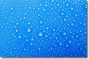
Weather Topic: What is Condensation?
Home - Education - Precipitation - Condensation
 Next Topic: Contrails
Condensation is the process which creates clouds, and therefore
it is a crucial process in the water cycle.
Condensation is the change of matter from a state of gas into a state of liquid,
and it happens because water molecules release heat into the atmosphere and
become organized into a more closely packed structure, what we might see as
water droplets.
Water is always present in the air around us as a vapor, but it's too small for
us to see. When water undergoes the process of condensation it becomes organized
into visible water droplets. You've probably seen condensation happen before on the
surface of a cold drink!
Next Topic: Contrails
Current conditions powered by WeatherAPI.com


