Weather Alert in Alaska
Flood Warning issued August 26 at 10:30PM AKDT until August 27 at 11:00PM AKDT by NWS Fairbanks AK
AREAS AFFECTED: Central Brooks Range; South Slopes Of The Central Brooks Range; Upper Koyukuk Valley; Dalton Highway Summits
DESCRIPTION: * WHAT...Flooding caused by excessive rainfall continues. * WHERE...Including the following areas, Central Brooks Range, Dalton Highway Summits, South Slopes Of The Central Brooks Range and Upper Koyukuk Valley. * WHEN...Until 1100 PM AKDT Wednesday. * IMPACTS...Flooding of rivers, creeks, streams, and other low-lying and flood-prone locations is imminent or occurring. * ADDITIONAL DETAILS... - At 1018 PM AKDT, River gauge reports indicate rises in water levels from heavy rain across the warned area. Flooding is ongoing. Between 4 and 6 inches of rain have fallen. Additional rainfall amounts of up to an inch are possible. - There is controlled traffic along the Dalton Highway between mile markers 140 and 240 due to road damage from flooding earlier today. Numerous landslides have also been reported by the public near Wiseman along steep slopes in the area. - For Slate Creek at Coldfoot: At 10:23pm the stage was 18.9 feet and receding. Flood Stage is 18.7 feet. - Http://www.weather.gov/aprfc
INSTRUCTION: Stay tuned to further developments by listening to your local radio, television, or NOAA Weather Radio for further information.
Want more detail? Get the Complete 7 Day and Night Detailed Forecast!
Current U.S. National Radar--Current
The Current National Weather Radar is shown below with a UTC Time (subtract 5 hours from UTC to get Eastern Time).

National Weather Forecast--Current
The Current National Weather Forecast and National Weather Map are shown below.

National Weather Forecast for Tomorrow
Tomorrow National Weather Forecast and Tomorrow National Weather Map are show below.

North America Water Vapor (Moisture)
This map shows recent moisture content over North America. Bright and colored areas show high moisture (ie, clouds); brown indicates very little moisture present; black indicates no moisture.

Weather Topic: What is Snow?
Home - Education - Precipitation - Snow
 Next Topic: Stratocumulus Clouds
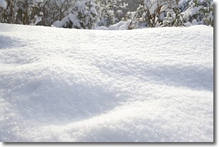
Snow is precipitation taking the form of ice crystals. Each ice crystal, or snowflake,
has unique characteristics, but all of them grow in a hexagonal structure.
Snowfall can last for sustained periods of time and result in significant buildup
of snow on the ground.
On the earth's surface, snow starts out light and powdery, but as it begins to melt
it tends to become more granular, producing small bits of ice which have the consistency of
sand. After several cycles of melting and freezing, snow can become very dense
and ice-like, commonly known as snow pack.
Next Topic: Stratocumulus Clouds
Weather Topic: What are Stratus Clouds?
Home - Education - Cloud Types - Stratus Clouds
 Next Topic: Wall Clouds
Stratus clouds are similar to altostratus clouds, but form at a
lower altitude and are identified by their fog-like appearance, lacking the
distinguishing features of most clouds.
Stratus clouds are wider than most clouds, and their base has a smooth, uniform
look which is lighter in color than a nimbostratus cloud.
The presence of a stratus cloud indicates the possibility of minor precipitation,
such as drizzle, but heavier precipitation does not typically arrive in the form
of a stratus cloud.
Next Topic: Wall Clouds
Current conditions powered by WeatherAPI.com


