Weather Alert in California
Winter Storm Watch issued February 13 at 11:29AM PST until February 18 at 10:00PM PST by NWS Sacramento CA
AREAS AFFECTED: Shasta Lake Area / Northern Shasta County; Burney Basin / Eastern Shasta County; Mountains Southwestern Shasta County to Western Colusa County; Northeast Foothills/Sacramento Valley; Motherlode; Western Plumas County/Lassen Park; West Slope Northern Sierra Nevada
DESCRIPTION: * WHAT...Heavy snow possible. Accumulation amounts are uncertain at this time, but may range from around a foot at 3000 to 4000 feet and 4 to 8 feet at higher elevations. Winds could gust as high as 55 mph. * WHERE...West Slope Northern Sierra Nevada and Western Plumas County/Lassen Park including Interstate 80 and Highway 50, northern Shasta County including portions of Interstate 5, the Coastal Range, and foothill regions of the Sierra Nevada. * WHEN...From Sunday evening through Wednesday evening. * IMPACTS...Dangerous to near impossible travel conditions with chain controls and road closures possible. Low visibility due to a combination of wind and heavy snow. * ADDITIONAL DETAILS...Snow levels will be around 4500-5000 feet Sunday night through Tuesday. Levels drop to 3000 to 4000 feet late Tuesday into Wednesday. Potential to see snow levels as low as 2000 feet for areas along the Coastal Range, around Shasta County, and in the southern Cascades.
INSTRUCTION: Check the latest road conditions from Caltrans online at quickmap.dot.ca.gov or dial 5 1 1.
Want more detail? Get the Complete 7 Day and Night Detailed Forecast!
Current U.S. National Radar--Current
The Current National Weather Radar is shown below with a UTC Time (subtract 5 hours from UTC to get Eastern Time).

National Weather Forecast--Current
The Current National Weather Forecast and National Weather Map are shown below.

National Weather Forecast for Tomorrow
Tomorrow National Weather Forecast and Tomorrow National Weather Map are show below.

North America Water Vapor (Moisture)
This map shows recent moisture content over North America. Bright and colored areas show high moisture (ie, clouds); brown indicates very little moisture present; black indicates no moisture.

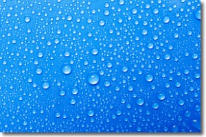
Weather Topic: What is Evaporation?
Home - Education - Precipitation - Evaporation
 Next Topic: Fog
Evaporation is the process which returns water from the earth
back to the atmosphere, and is another crucial process in the water cycle.
Evaporation is the transformation of liquid into gas, and it happens because
molecules are excited by the application of energy and turn into vapor.
In order for water to evaporate it has to be on the surface of a body of water.
Next Topic: Fog
Weather Topic: What are Fractus Clouds?
Home - Education - Cloud Types - Fractus Clouds
 Next Topic: Freezing Rain
A fractus cloud (scud) is a fragmented, tattered cloud which has
likely been sheared off of another cloud. They are accessory clouds, meaning they
develop from parent clouds, and are named in a way which describes the original
cloud which contained them.
Fractus clouds which have originated from cumulus clouds are referred to as
cumulus fractus, while fractus clouds which have originated from stratus clouds
are referred to as stratus fractus. Under certain conditions a fractus cloud might
merge with another cloud, or develop into a cumulus cloud, but usually a
fractus cloud seen by itself will dissipate rapidly.
They are often observed on the leading and trailing edges of storm clouds,
and are a display of wind activity.
Next Topic: Freezing Rain
Current conditions powered by WeatherAPI.com


