Weather Alert in Colorado
Fire Weather Watch issued February 17 at 10:43AM MST until February 18 at 5:00PM MST by NWS Goodland KS
AREAS AFFECTED: Yuma; Kit Carson County; Cheyenne; Cheyenne; Sherman; Wallace; Greeley
DESCRIPTION: Red Flag Warnings continue today for the entire area. This is particularly dangerous situation for western areas due to the combination of strong winds, low humidity and dry fuels. A new Fire Weather Watch has been issued for tomorrow for areas generally along and west of a line from Wray, Colorado, to Russell Springs and Leoti, Kansas. Southwest winds will increase in the afternoon with gusts of 25 to 45 mph and humidity as low as 15 percent. The National Weather Service in Goodland has issued a Fire Weather Watch for wind and low relative humidity, which is in effect from Wednesday morning through Wednesday afternoon. * AFFECTED AREA...THIS IS A PARTICULARLY DANGEROUS SITUATION FOR Fire Weather Zones 001 Cheyenne, 013 Sherman, 027 Wallace, 041 Greeley, 252 Yuma, 253 Kit Carson and 254 Cheyenne. * TIMING...For the Red Flag Warning, until 8 PM MST /9 PM CST/ this evening. For the Fire Weather Watch, from Wednesday morning through Wednesday afternoon. * WINDS...Southwest 35 to 45 mph with gusts up to 65 mph. * RELATIVE HUMIDITY...As low as 12 percent. * IMPACTS...Extremely dangerous and erratic fire behavior. Any fires that develop will rapidly grow and spread out of control.
INSTRUCTION: Comply with burn bans and regulations. Avoid driving on dry grass or brush. Maintain vehicle brakes and tires and secure tow chains to avoid dragging. Mow lawns early in the morning, when it isn't windy or excessively dry. Never toss lit cigarettes onto the ground. Evacuate if fire/smoke is heading your way, or if ordered to do so by local officials.
Want more detail? Get the Complete 7 Day and Night Detailed Forecast!
Current U.S. National Radar--Current
The Current National Weather Radar is shown below with a UTC Time (subtract 5 hours from UTC to get Eastern Time).

National Weather Forecast--Current
The Current National Weather Forecast and National Weather Map are shown below.

National Weather Forecast for Tomorrow
Tomorrow National Weather Forecast and Tomorrow National Weather Map are show below.

North America Water Vapor (Moisture)
This map shows recent moisture content over North America. Bright and colored areas show high moisture (ie, clouds); brown indicates very little moisture present; black indicates no moisture.

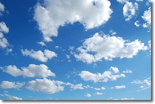
Weather Topic: What are Cumulonimbus Clouds?
Home - Education - Cloud Types - Cumulonimbus Clouds
 Next Topic: Cumulus Clouds
The final form taken by a growing cumulus cloud is the
cumulonimbus cloud, which is very tall and dense.
The tower of a cumulonimbus cloud can soar 23 km into the atmosphere, although
most commonly they stop growing at an altitude of 6 km.
Even small cumulonimbus clouds appear very large in comparison to other cloud types.
They can signal the approach of stormy weather, such as thunderstorms or blizzards.
Next Topic: Cumulus Clouds
Weather Topic: What is Drizzle?
Home - Education - Precipitation - Drizzle
 Next Topic: Evaporation
Drizzle is precipitation in the form of water droplets which are
smaller than raindrops.
Drizzle is characterized by fine, gently falling droplets and typically does not
impact human habitation in a negative way. The exception to this is freezing drizzle,
a condition where drizzle freezes immediately upon reaching earth's surface.
Freezing drizzle is still less dangerous than freezing rain, but can
potentially result in hazardous road conditions.
Next Topic: Evaporation
Current conditions powered by WeatherAPI.com


