Weather Alert in Minnesota
Winter Storm Warning issued February 16 at 1:23PM CST until February 19 at 12:00PM CST by NWS Duluth MN
AREAS AFFECTED: Central St. Louis; Carlton/South St. Louis
DESCRIPTION: * WHAT...Heavy snow with light ice accumulations expected. Total snow accumulations between 5 and 8 inches except between 8 and 11 inches for the higher terrain northeast of Duluth. Ice accumulations around one tenth of an inch. East winds gusting as high as 55 mph. * WHERE...Carlton and South and Central St. Louis Counties. This includes the Tribal Lands of the Fond du Lac Band and the Bois Forte Band, Lake Vermilion area. * WHEN...From 6 PM Tuesday to noon CST Thursday. * IMPACTS...The strong winds and weight of snow on tree limbs may down power lines and could cause sporadic power outages. Travel could be very difficult. The hazardous conditions could impact the Wednesday morning and evening commutes. * ADDITIONAL DETAILS...The strongest winds are expected Tuesday evening through Wednesday morning from the east off Lake Superior. Near whiteout conditions are possible for a few hour period late Tuesday night as high snowfall rates could combine with those peak winds gusting to 55 mph.
INSTRUCTION: If you must travel, keep an extra flashlight, food, and water in your vehicle in case of an emergency. Call 511 or visit www.511mn.org for Minnesota road information. Do not touch downed lines and report any power outages to your electric company. Slick roadways and the possibility of downed trees and power lines may create hazardous travel conditions.
Want more detail? Get the Complete 7 Day and Night Detailed Forecast!
Current U.S. National Radar--Current
The Current National Weather Radar is shown below with a UTC Time (subtract 5 hours from UTC to get Eastern Time).

National Weather Forecast--Current
The Current National Weather Forecast and National Weather Map are shown below.

National Weather Forecast for Tomorrow
Tomorrow National Weather Forecast and Tomorrow National Weather Map are show below.

North America Water Vapor (Moisture)
This map shows recent moisture content over North America. Bright and colored areas show high moisture (ie, clouds); brown indicates very little moisture present; black indicates no moisture.

Weather Topic: What is Snow?
Home - Education - Precipitation - Snow
 Next Topic: Stratocumulus Clouds
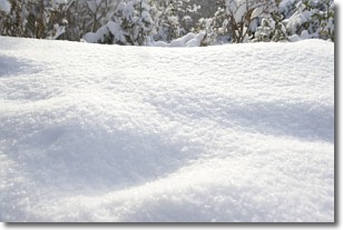
Snow is precipitation taking the form of ice crystals. Each ice crystal, or snowflake,
has unique characteristics, but all of them grow in a hexagonal structure.
Snowfall can last for sustained periods of time and result in significant buildup
of snow on the ground.
On the earth's surface, snow starts out light and powdery, but as it begins to melt
it tends to become more granular, producing small bits of ice which have the consistency of
sand. After several cycles of melting and freezing, snow can become very dense
and ice-like, commonly known as snow pack.
Next Topic: Stratocumulus Clouds
Weather Topic: What are Stratus Clouds?
Home - Education - Cloud Types - Stratus Clouds
 Next Topic: Wall Clouds
Stratus clouds are similar to altostratus clouds, but form at a
lower altitude and are identified by their fog-like appearance, lacking the
distinguishing features of most clouds.
Stratus clouds are wider than most clouds, and their base has a smooth, uniform
look which is lighter in color than a nimbostratus cloud.
The presence of a stratus cloud indicates the possibility of minor precipitation,
such as drizzle, but heavier precipitation does not typically arrive in the form
of a stratus cloud.
Next Topic: Wall Clouds
Current conditions powered by WeatherAPI.com


