Weather Alert in California
Winter Storm Watch issued February 13 at 11:06AM PST until February 18 at 10:00PM PST by NWS Reno NV
AREAS AFFECTED: Greater Lake Tahoe Area; Greater Lake Tahoe Area
DESCRIPTION: * WHAT...Heavy snow. Snow accumulations between 18 to 30 inches in the Tahoe Basin, highest on the west shore, and much of Alpine County. This includes Tahoe City, Homewood, South Lake Tahoe, Carnelian Bay, Hope Valley, and Markleeville. Sierra snow accumulation of 2 to 5 feet. Winds gusting 35 to 45 mph in valleys, with Sierra ridge gusts over 100 mph. * WHERE...Greater Lake Tahoe Area. * WHEN...From Sunday evening through Wednesday evening. * IMPACTS...Travel could be very difficult to impossible with periods of white out conditions. Very strong winds could cause damage to trees and power lines. * ADDITIONAL DETAILS...The highest snowfall rates will be late Monday afternoon through Tuesday afternoon.
INSTRUCTION: Monitor the latest forecasts for updates on this situation. Persons should consider delaying all travel. Motorists should use extreme caution if travel is absolutely necessary.
Want more detail? Get the Complete 7 Day and Night Detailed Forecast!
Current U.S. National Radar--Current
The Current National Weather Radar is shown below with a UTC Time (subtract 5 hours from UTC to get Eastern Time).

National Weather Forecast--Current
The Current National Weather Forecast and National Weather Map are shown below.

National Weather Forecast for Tomorrow
Tomorrow National Weather Forecast and Tomorrow National Weather Map are show below.

North America Water Vapor (Moisture)
This map shows recent moisture content over North America. Bright and colored areas show high moisture (ie, clouds); brown indicates very little moisture present; black indicates no moisture.

Weather Topic: What are Nimbostratus Clouds?
Home - Education - Cloud Types - Nimbostratus Clouds
 Next Topic: Precipitation
A nimbostratus cloud is similar to a stratus cloud in its formless,
smooth appearance. However, a nimbostratus cloud is darker than a stratus cloud,
because it is thicker.
Unlike a stratus cloud, a nimbostratus cloud typically brings with it the threat
of moderate to heavy precipitation. In some cases, the precipitation may evaporate
before reaching the ground, a phenomenon known as virga.
Next Topic: Precipitation
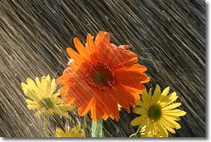
Weather Topic: What is Rain?
Home - Education - Precipitation - Rain
 Next Topic: Shelf Clouds
Precipitation in the form of water droplets is called rain.
Rain generally has a tendency to fall with less intensity over a greater period
of time, and when rainfall is more severe it is usually less sustained.
Rain is the most common form of precipitation and happens with greater frequency
depending on the season and regional influences. Cities have been shown to have
an observable effect on rainfall, due to an effect called the urban heat island.
Compared to upwind, monthly rainfall between twenty and forty miles downwind of
cities is 30% greater.
Next Topic: Shelf Clouds
Current conditions powered by WeatherAPI.com


