Weather Alert in Kentucky
Winter Weather Advisory issued February 22 at 10:51PM EST until February 23 at 7:00PM EST by NWS Jackson KY
AREAS AFFECTED: Harlan; Floyd; Knott; Perry; Letcher; Martin; Pike
DESCRIPTION: * WHAT...Rounds of snow showers. Additional snow accumulations between 11 PM EST Sunday to 7 PM Monday of a half an inch to 2 inches. Locally higher amounts are possible in any areas of more persistent snow showers. Accumulations up to 4 inches are possible above 3000 feet elevation. * WHERE...Portions of northeast and southeast Kentucky. * WHEN...Until 7 PM EST Monday. * IMPACTS...Plan on times of slick, slushy, or snow covered roads and significant differences in road conditions over rather short distances. During or following a snow shower, any untreated roads and surfaces, as well as bridges and overpasses, may be icy in some locations. The hazardous conditions could impact the Monday morning and evening commutes.
INSTRUCTION: If traveling tonight or Monday, slow down and exercise caution while traveling. Allow plenty of extra time to reach your destination. The latest road conditions for Kentucky can be found by visiting https://goky.ky.gov.
Want more detail? Get the Complete 7 Day and Night Detailed Forecast!
Current U.S. National Radar--Current
The Current National Weather Radar is shown below with a UTC Time (subtract 5 hours from UTC to get Eastern Time).

National Weather Forecast--Current
The Current National Weather Forecast and National Weather Map are shown below.

National Weather Forecast for Tomorrow
Tomorrow National Weather Forecast and Tomorrow National Weather Map are show below.

North America Water Vapor (Moisture)
This map shows recent moisture content over North America. Bright and colored areas show high moisture (ie, clouds); brown indicates very little moisture present; black indicates no moisture.

Weather Topic: What is Condensation?
Home - Education - Precipitation - Condensation
 Next Topic: Contrails
Condensation is the process which creates clouds, and therefore
it is a crucial process in the water cycle.
Condensation is the change of matter from a state of gas into a state of liquid,
and it happens because water molecules release heat into the atmosphere and
become organized into a more closely packed structure, what we might see as
water droplets.
Water is always present in the air around us as a vapor, but it's too small for
us to see. When water undergoes the process of condensation it becomes organized
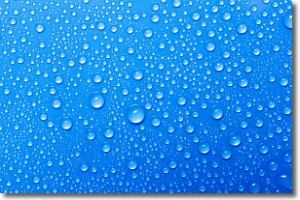
into visible water droplets. You've probably seen condensation happen before on the
surface of a cold drink!
Next Topic: Contrails
Weather Topic: What are Cumulonimbus Clouds?
Home - Education - Cloud Types - Cumulonimbus Clouds
 Next Topic: Cumulus Clouds
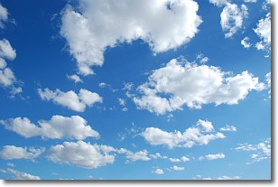
The final form taken by a growing cumulus cloud is the
cumulonimbus cloud, which is very tall and dense.
The tower of a cumulonimbus cloud can soar 23 km into the atmosphere, although
most commonly they stop growing at an altitude of 6 km.
Even small cumulonimbus clouds appear very large in comparison to other cloud types.
They can signal the approach of stormy weather, such as thunderstorms or blizzards.
Next Topic: Cumulus Clouds
Current conditions powered by WeatherAPI.com


