Weather Alert in New York
Winter Storm Watch issued February 19 at 1:21AM EST until February 21 at 10:00AM EST by NWS Burlington VT
AREAS AFFECTED: Eastern Clinton; Western Clinton; Western Essex; Eastern Essex; Eastern Addison; Eastern Rutland; Western Windsor
DESCRIPTION: * WHAT...Heavy snow possible. Total snow accumulations between 4 and 9 inches possible. * WHERE...Portions of northern New York and central and southern Vermont. * WHEN...From Friday morning through Saturday morning. * IMPACTS...Travel could be very difficult. The hazardous conditions could impact the Friday evening commute. * ADDITIONAL DETAILS...Snow will be initially wet, and the potential exists for 1 inch per hour snowfall rates Friday evening. Snow will trend lighter and become increasingly dry. Isolated power outages could occur before snow characteristics trend drier.
INSTRUCTION: Monitor the latest forecasts for updates on this situation.
Want more detail? Get the Complete 7 Day and Night Detailed Forecast!
Current U.S. National Radar--Current
The Current National Weather Radar is shown below with a UTC Time (subtract 5 hours from UTC to get Eastern Time).

National Weather Forecast--Current
The Current National Weather Forecast and National Weather Map are shown below.

National Weather Forecast for Tomorrow
Tomorrow National Weather Forecast and Tomorrow National Weather Map are show below.

North America Water Vapor (Moisture)
This map shows recent moisture content over North America. Bright and colored areas show high moisture (ie, clouds); brown indicates very little moisture present; black indicates no moisture.

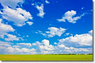
Weather Topic: What are Cumulus Clouds?
Home - Education - Cloud Types - Cumulus Clouds
 Next Topic: Drizzle
Cumulus clouds are fluffy and textured with rounded tops, and
may have flat bottoms. The border of a cumulus cloud
is clearly defined, and can have the appearance of cotton or cauliflower.
Cumulus clouds form at low altitudes (rarely above 2 km) but can grow very tall,
becoming cumulus congestus and possibly the even taller cumulonimbus clouds.
When cumulus clouds become taller, they have a greater chance of producing precipitation.
Next Topic: Drizzle
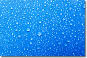
Weather Topic: What is Evaporation?
Home - Education - Precipitation - Evaporation
 Next Topic: Fog
Evaporation is the process which returns water from the earth
back to the atmosphere, and is another crucial process in the water cycle.
Evaporation is the transformation of liquid into gas, and it happens because
molecules are excited by the application of energy and turn into vapor.
In order for water to evaporate it has to be on the surface of a body of water.
Next Topic: Fog
Current conditions powered by WeatherAPI.com


