Weather Alert in Connecticut
Flood Watch issued March 16 at 3:04PM EDT until March 17 at 8:00AM EDT by NWS Boston/Norton MA
AREAS AFFECTED: Hartford; Tolland; Windham; Western Franklin; Eastern Franklin; Northern Worcester; Central Middlesex County; Western Essex; Eastern Essex; Western Hampshire; Western Hampden; Eastern Hampshire; Eastern Hampden; Southern Worcester; Western Norfolk; Southeast Middlesex; Suffolk; Eastern Norfolk; Northern Bristol; Western Plymouth; Eastern Plymouth; Southern Bristol; Southern Plymouth; Barnstable; Northwest Middlesex County; Northwest Providence; Southeast Providence; Western Kent; Eastern Kent; Bristol; Washington; Newport
DESCRIPTION: * WHAT...Flooding is possible from periods of heavy rain through tonight combined with last week/s snow melt. * WHERE...All of southern New England except the outer-Islands. * WHEN...Through Tuesday morning. * IMPACTS...Excessive runoff may result in flooding of rivers, creeks, streams, and other low-lying and flood-prone locations. Flooding may occur in poor drainage and urban areas. Area creeks and streams are running high and could flood with more heavy rain. * ADDITIONAL DETAILS... - Periods of heavy showers and potentially a few embedded thunder will continue through tonight. This combined with last week/s snow melt may result in some river and small stream flooding as well as pockets poor drainage street flooding. - http://www.weather.gov/safety/flood
INSTRUCTION: You should monitor later forecasts and be alert for possible Flood Warnings. Those living in areas prone to flooding should be prepared to take action should flooding develop.
Want more detail? Get the Complete 7 Day and Night Detailed Forecast!
Current U.S. National Radar--Current
The Current National Weather Radar is shown below with a UTC Time (subtract 5 hours from UTC to get Eastern Time).

National Weather Forecast--Current
The Current National Weather Forecast and National Weather Map are shown below.

National Weather Forecast for Tomorrow
Tomorrow National Weather Forecast and Tomorrow National Weather Map are show below.

North America Water Vapor (Moisture)
This map shows recent moisture content over North America. Bright and colored areas show high moisture (ie, clouds); brown indicates very little moisture present; black indicates no moisture.

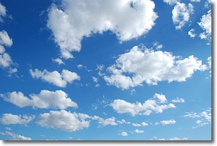
Weather Topic: What are Cumulonimbus Clouds?
Home - Education - Cloud Types - Cumulonimbus Clouds
 Next Topic: Cumulus Clouds
The final form taken by a growing cumulus cloud is the
cumulonimbus cloud, which is very tall and dense.
The tower of a cumulonimbus cloud can soar 23 km into the atmosphere, although
most commonly they stop growing at an altitude of 6 km.
Even small cumulonimbus clouds appear very large in comparison to other cloud types.
They can signal the approach of stormy weather, such as thunderstorms or blizzards.
Next Topic: Cumulus Clouds
Weather Topic: What is Drizzle?
Home - Education - Precipitation - Drizzle
 Next Topic: Evaporation
Drizzle is precipitation in the form of water droplets which are
smaller than raindrops.
Drizzle is characterized by fine, gently falling droplets and typically does not
impact human habitation in a negative way. The exception to this is freezing drizzle,
a condition where drizzle freezes immediately upon reaching earth's surface.
Freezing drizzle is still less dangerous than freezing rain, but can
potentially result in hazardous road conditions.
Next Topic: Evaporation
Current conditions powered by WeatherAPI.com


