Weather Alert in Texas
Dense Fog Advisory issued February 13 at 6:16PM CST until February 14 at 6:00AM CST by NWS Houston/Galveston TX
AREAS AFFECTED: Chambers; Inland Galveston; Coastal Galveston; Galveston Island; Bolivar Peninsula
DESCRIPTION: * WHAT...Visibility one quarter mile or less in dense fog. * WHERE...Bolivar Peninsula, Chambers, Coastal Galveston, Galveston Island, and Inland Galveston Counties. * WHEN...Until 6 AM CST Saturday. * IMPACTS...Low visibility could make driving conditions hazardous. * ADDITIONAL DETAILS...Visibility will continue to deteriorate as sea fog moves in from the adjacent coastal waters. Barrier islands are most at risk for persistent quarter mile visibility this evening. Some visibility improvements may occur during the pre-dawn hours of Saturday morning.
INSTRUCTION: If driving, slow down, use your headlights, and leave plenty of distance ahead of you.
Want more detail? Get the Complete 7 Day and Night Detailed Forecast!
Current U.S. National Radar--Current
The Current National Weather Radar is shown below with a UTC Time (subtract 5 hours from UTC to get Eastern Time).

National Weather Forecast--Current
The Current National Weather Forecast and National Weather Map are shown below.

National Weather Forecast for Tomorrow
Tomorrow National Weather Forecast and Tomorrow National Weather Map are show below.

North America Water Vapor (Moisture)
This map shows recent moisture content over North America. Bright and colored areas show high moisture (ie, clouds); brown indicates very little moisture present; black indicates no moisture.

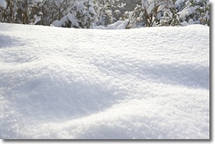
Weather Topic: What is Snow?
Home - Education - Precipitation - Snow
 Next Topic: Stratocumulus Clouds
Snow is precipitation taking the form of ice crystals. Each ice crystal, or snowflake,
has unique characteristics, but all of them grow in a hexagonal structure.
Snowfall can last for sustained periods of time and result in significant buildup
of snow on the ground.
On the earth's surface, snow starts out light and powdery, but as it begins to melt
it tends to become more granular, producing small bits of ice which have the consistency of
sand. After several cycles of melting and freezing, snow can become very dense
and ice-like, commonly known as snow pack.
Next Topic: Stratocumulus Clouds
Weather Topic: What are Stratus Clouds?
Home - Education - Cloud Types - Stratus Clouds
 Next Topic: Wall Clouds
Stratus clouds are similar to altostratus clouds, but form at a
lower altitude and are identified by their fog-like appearance, lacking the
distinguishing features of most clouds.
Stratus clouds are wider than most clouds, and their base has a smooth, uniform
look which is lighter in color than a nimbostratus cloud.
The presence of a stratus cloud indicates the possibility of minor precipitation,
such as drizzle, but heavier precipitation does not typically arrive in the form
of a stratus cloud.
Next Topic: Wall Clouds
Current conditions powered by WeatherAPI.com


