Weather Alert in Colorado
Fire Weather Watch issued February 14 at 2:13AM MST until February 17 at 8:00PM MST by NWS Goodland KS
AREAS AFFECTED: Cheyenne
DESCRIPTION: For Sunday, southwest winds of 15-20 mph are forecast to begin around 8-9 am Mountain time across Yuma and Kit Carson county before expanding east into the remainder of the Fire Weather Watch through the afternoon. For Tuesday, low relative humidity and sustained winds around 40 mph could lead to explosive fire growth for fires that ignite. Southwest winds could change to west behind a cold front in the afternoon. * AFFECTED AREA...Fire Weather Zone 254 Cheyenne. * TIMING...From Tuesday morning through Tuesday evening. * WINDS...West 35 to 45 mph with gusts up to 60 mph. * RELATIVE HUMIDITY...Around 12 percent. * IMPACTS...Dangerous and unpredictable fire behavior. Any fires that develop may rapidly grow and spread out of control.
INSTRUCTION: A Fire Weather Watch means that critical fire weather conditions are forecast to occur. Listen for later forecasts and possible red flag warnings.
Want more detail? Get the Complete 7 Day and Night Detailed Forecast!
Current U.S. National Radar--Current
The Current National Weather Radar is shown below with a UTC Time (subtract 5 hours from UTC to get Eastern Time).

National Weather Forecast--Current
The Current National Weather Forecast and National Weather Map are shown below.

National Weather Forecast for Tomorrow
Tomorrow National Weather Forecast and Tomorrow National Weather Map are show below.

North America Water Vapor (Moisture)
This map shows recent moisture content over North America. Bright and colored areas show high moisture (ie, clouds); brown indicates very little moisture present; black indicates no moisture.

Weather Topic: What is Evaporation?
Home - Education - Precipitation - Evaporation
 Next Topic: Fog
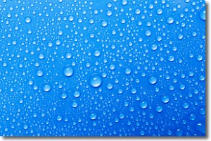
Evaporation is the process which returns water from the earth
back to the atmosphere, and is another crucial process in the water cycle.
Evaporation is the transformation of liquid into gas, and it happens because
molecules are excited by the application of energy and turn into vapor.
In order for water to evaporate it has to be on the surface of a body of water.
Next Topic: Fog
Weather Topic: What are Fractus Clouds?
Home - Education - Cloud Types - Fractus Clouds
 Next Topic: Freezing Rain
A fractus cloud (scud) is a fragmented, tattered cloud which has
likely been sheared off of another cloud. They are accessory clouds, meaning they
develop from parent clouds, and are named in a way which describes the original
cloud which contained them.
Fractus clouds which have originated from cumulus clouds are referred to as
cumulus fractus, while fractus clouds which have originated from stratus clouds
are referred to as stratus fractus. Under certain conditions a fractus cloud might
merge with another cloud, or develop into a cumulus cloud, but usually a
fractus cloud seen by itself will dissipate rapidly.
They are often observed on the leading and trailing edges of storm clouds,
and are a display of wind activity.
Next Topic: Freezing Rain
Current conditions powered by WeatherAPI.com


