Weather Alert in Kansas
Fire Weather Watch issued February 14 at 2:13AM MST until February 17 at 8:00PM MST by NWS Goodland KS
AREAS AFFECTED: Cheyenne; Rawlins; Sherman; Dundy; Hitchcock; Red Willow
DESCRIPTION: For Sunday, southwest winds of 15-20 mph are forecast to begin around 8-9 am Mountain time across Yuma and Kit Carson county before expanding east into the remainder of the Fire Weather Watch through the afternoon. For Tuesday, low relative humidity and sustained winds around 40 mph could lead to explosive fire growth for fires that ignite. Southwest winds could change to west behind a cold front in the afternoon. The National Weather Service in Goodland has issued a Fire Weather Watch for wind and low relative humidity, which is in effect from Tuesday morning through Tuesday evening. * AFFECTED AREA...Fire Weather Zones 001 Cheyenne, 002 Rawlins, 013 Sherman, 079 Dundy, 080 Hitchcock and 081 Red Willow. * TIMING...For the first Fire Weather Watch, from Sunday morning through Sunday afternoon. For the second Fire Weather Watch, from Tuesday morning through Tuesday evening. * WINDS...For Sunday, southwest winds of 10-20 mph gusting to 30 mph. For Tuesday, southwest 20 to 30 mph with gusts up to 45 mph. * RELATIVE HUMIDITY...Around 12 percent. * IMPACTS...Unpredictable fire behavior. Any fires that develop may rapidly grow and spread out of control.
INSTRUCTION: A Fire Weather Watch means that critical fire weather conditions are forecast to occur. Listen for later forecasts and possible red flag warnings.
Want more detail? Get the Complete 7 Day and Night Detailed Forecast!
Current U.S. National Radar--Current
The Current National Weather Radar is shown below with a UTC Time (subtract 5 hours from UTC to get Eastern Time).

National Weather Forecast--Current
The Current National Weather Forecast and National Weather Map are shown below.

National Weather Forecast for Tomorrow
Tomorrow National Weather Forecast and Tomorrow National Weather Map are show below.

North America Water Vapor (Moisture)
This map shows recent moisture content over North America. Bright and colored areas show high moisture (ie, clouds); brown indicates very little moisture present; black indicates no moisture.

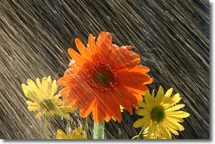
Weather Topic: What is Rain?
Home - Education - Precipitation - Rain
 Next Topic: Shelf Clouds
Precipitation in the form of water droplets is called rain.
Rain generally has a tendency to fall with less intensity over a greater period
of time, and when rainfall is more severe it is usually less sustained.
Rain is the most common form of precipitation and happens with greater frequency
depending on the season and regional influences. Cities have been shown to have
an observable effect on rainfall, due to an effect called the urban heat island.
Compared to upwind, monthly rainfall between twenty and forty miles downwind of
cities is 30% greater.
Next Topic: Shelf Clouds
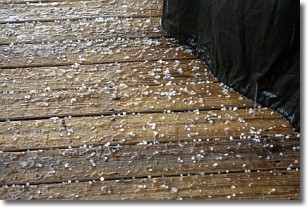
Weather Topic: What is Sleet?
Home - Education - Precipitation - Sleet
 Next Topic: Snow
Sleet is a form of precipitation in which small ice pellets are the primary
components. These ice pellets are smaller and more translucent than hailstones,
and harder than graupel. Sleet is caused by specific atmospheric conditions and
therefore typically doesn't last for extended periods of time.
The condition which leads to sleet formation requires a warmer body of air to be
wedged in between two sub-freezing bodies of air. When snow falls through a warmer
layer of air it melts, and as it falls through the next sub-freezing body of air
it freezes again, forming ice pellets known as sleet. In some cases, water
droplets don't have time to freeze before reaching the surface and the result is
freezing rain.
Next Topic: Snow
Current conditions powered by WeatherAPI.com


